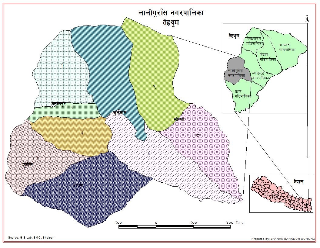
Laligurans Municipality
Fact sheet
Laligurans Municipality lies in Terhathum District of Province 1. It was established in 2072 BS. Basantapur, Phulek, Solma, Sungnam & Dangpa Rural Municipalities were merged to form Laligurans Municipality. 32.37% of population are Limbu and 29.69% are Chhetris followed by 7.72% of Gurungs. Percentage share to total urban population is 0.10% only.
Budget for fiscal year 078/79 BS (Rs. in 000′)
466069
Literacy Rate of the Municipality (both sex)
75.65%
Number of voters registered in the election commission (2074 BS)
10673
Households with access to safe drinking water
81.5%
Socio-Economic Indicators
| Municipality Fact Sheet | |
|---|---|
| Established Year (BS) | 2072 |
| Federal State | Province 1 |
| District | Terhathum |
| Area (sq. km) | 90.27 |
| No. of Wards | 9 |
| Population (2011) | 16934 |
| Female Population | 9206 |
| Male Population | 7728 |
| Sex Ratio (M: F) | 83.95 |
| Total Household | 3677 |
| Average Household Size | 4.61 |
| Density of Population (persons/sq. km.) | 187.59 |
| Population by major ethnic group (percentage) | |
| Limbu | 32.37 |
| Chhetri | 29.69 |
| Gurung | 7.72 |
| Brahmin Hill | 6.41 |
| Magar | 6.39 |
| Literacy Rate (%) | |
| Both Sex | 75.65 |
| Male | 84.78 |
| Female | 68.14 |
| Total No. of Voters | 10673 |
| Female | 5246 |
| Male | 5427 |
| Ranking Among Municipalities | |
| By Area | 204 |
| By Population | 286 |
| By Density of Population | 234 |
| Percentage Share to District Population (%) | 16.67 |
| Percentage Share to Total Urban Population (%) | 0.1 |
| Percentage Share to District Area (%) | 13.39 |
| Households with Access to Safe Drinking Water (%) | 81.5 |
| Households using Wood as Fuel for cooking | 94.8 |
| Households with Access to Electricity (%) | 90.4 |
| Financial Institutions | |
| Banks | 3 |
| Micro Finance | 4 |
| Life Insurance Companies | 3 |
| Cooperatives | 46 |
| Forest | |
| Community Forest (Ha) | 2828.12 |
| Private Forest (Ha) | 3.59 |
| Leasehold Forest (Ha) | 18.05 |
| Number of Schools (Public & Institutional) | 38 |

